Three of us recently spent seven days walking in a triangle of country starting from Narrina HS at the southern apex and in the north, extending west to Mt Goddard (NW of the Mt Hack range) and 16 km east to Purnuna Spring.
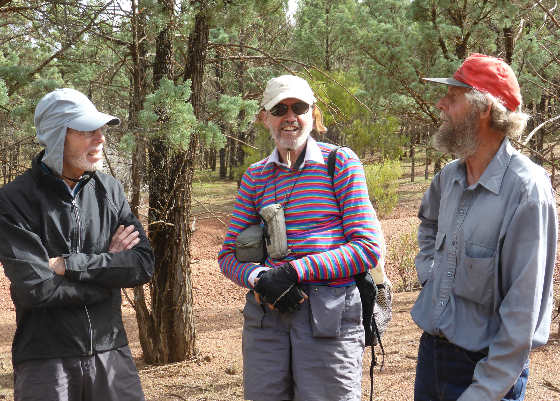
Besides myself, the party consisted of Greg Mullins and Rob Jung. Greg is a recently qualified full club member in his mid 70s. He formerly played for Central District until living and working in the country finally made a stronger call than league football. On both counts, he’s full of stories! Rob is from the Sydney based Coast and Mountain Bushwalkers and has walked extensively in the Flinders. Rob is very inventive in designing and making bushwalking gear of his own design and came with homemade ultralight wood stove, tent and gaiters. Both Rob and Greg had homemade rucksacks of their own design.
We arrived at Narrina late on Saturday afternoon and spent the night in the shearers quarters. The station is owned by Alan Ireland and his father Jack and for about an hour, Jack kept us well entertained with stories. One tale that brought a twinkle to his eye was his recalling of the time decades ago when a sheep bunted him over a hilltop cliff and he was finally found by searchers at 2 AM with a seriously broken leg. Jack is 93 years old and proudly told us that he still does 4-5 hours of work a day.
While earlier I wrote of ‘starting’ from Narrina, Alan in fact very kindly drove us 32 km north across the Pound and past Main Gap. This was a big help because we were destined to return the same way on foot and it allowed us to soon walk to Windy Creek and follow it for much of the afternoon to a campsite not far from Mocatoona Spring. Thus ended the first day in our quest to cover a fair bit of country and visit several widely scattered peaks and springs.
Early the following morning and without packs, we walked to Mocatoona Spring on the way to Mt Goddard. Rob lead the way as he’d previously established that the spring is 400 m from the position indicated on the map. It’s certainly an interesting spring, flowing as it does from the base of a gum tree above a dry gully and its water collected into an old stone tank.
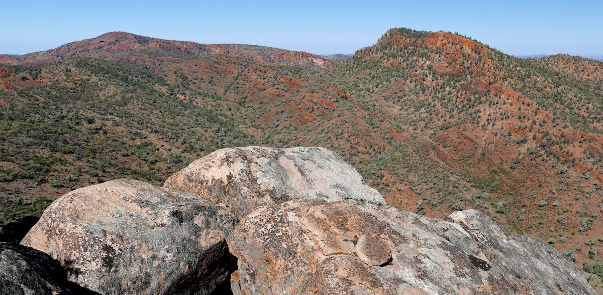
Mt Goddard aroused my interest some years ago when I first saw it with from Mocatoona Hill at sunset. Its slopes appeared dull red in colour and in that respect, it stood out from its surroundings. We now saw it in the light of day and it looked no different from its neighbours although it is still unusual – a wide 9 km long bumpy plateau-like structure with its high point (770 m) lying near the eastern end and about 5 km from the where its name is shown on the topo. map. On the way back to camp and out of interest, we detoured to Helling Well and I was interested to hear Greg explain how to turn the bore’s blades off the wind and so shut it down. We arrived back at camp just before dark.
Apart from the frivolous pursuit of summits, an unexpected highlight of the trip for me was the 23 km walk on day 3 between Mocatoona and Purnuna Springs and this was followed by a day walking south to the proximity of Woolroona Spring. On both days, the walking was partly on station roads but for most of the time it was along creek beds which in places were flowing.
An aim of the trip was to collect information to contribute to the club’s Northern Flinders Ranges’ Springs and Water Sources Project. Rob has a scientific background is in water chemistry and has made a major contribution to the project’s data base. As on previous walks in the region, he made notes on the springs and some of the waterholes we encountered and also recorded their total ion concentration. (If interested in knowing about how to clear and purify found waters on bushwalks, go to Rob’s article http://www.cmw.asn.au/articles/Water%20 Collecting%20and%20Purifying.pdf.)
The data we got on springs was a bit limited because of the fairly abundant water due to two heavy rainfalls in the area in recent months and it wasn’t possible, for example, to even identify Purnuna Spring because of extensive water in the creek bed. Similar to this though still useful, was finding that Waukawoodna Gap which we detoured to, contained several large pools though it has no water in drier times despite a spring of the same name being indicated on the map. Rob did however find what appeared to be a couple of transient springs. In relation to water sources, we did manage to locate and plot the position of a water tank in a very useful location for walkers
but not shown on the map. Earlier on, the tank’s owner kindly offered to make the tank available for use by club members.
The following morning, we headed south into the narrowing V-shaped valley between the two northerly ranges of the Mt Andre massif and late in the morning, stopped at a suitable campsite. On the way, we failed to find Alieroona Spring, confirming the owner’s view and my earlier experience that it doesn’t appear to exist. If there actually is a spring, then there is a serious map error. It’s a pity because a permanent spring at the location shown on the map would be extremely handy for walkers camped in the area to tackle Mt Andre from the north.
Climbing the Cocks Comb was on the afternoon’s agenda but I was too hasty trying to get to high ground, so we ended up with a much longer ridgetop walk than necessary. With its rough ground and a serious decent and climb, it was clear that we had no choice but to keep up a pressing pace and this turned out to be necessary for the rest of the afternoon.
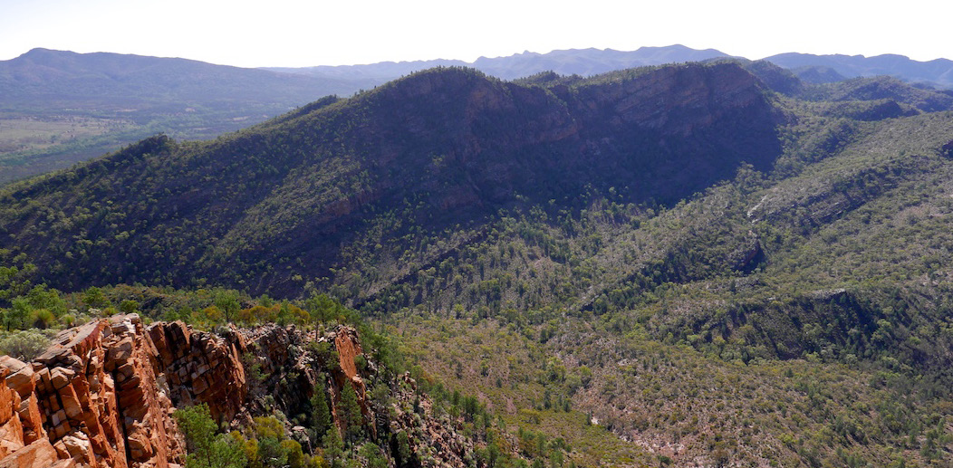
I can summarize the Cocks Comb by saying that its ridgeline is a true delight to walk along because much of the way is along 2 to 3-metrewide smooth and scrub-free rock that tops the east-facing cliffs of its two summits. It’s a marvellous peak.
The descent also came with a surprise because we unexpectedly found ourselves in a south draining watershed and this meant a long traverse and climb to the top of a ridge that separated us from the northern valley with our camp. That complexity in the ridgeline is apparent with close scrutiny of the map’s contour lines but I think that situation may have resulted from our need to avoid cliffs. From there, the descent was further slowed by cliffs and steep and occasionally choked gullies and it was in fading light that we finally arrived back at camp. That particular escapade was the only hard walking of the trip and I think that Greg felt pleased that he elected to give it a miss.
The last two days were concerned with getting back to Narrina and on the final day we followed the surprisingly flowing creeks behind the great tilted limestone wedge of Ben Lomond and its smaller copycat neighbours. Despite its visual dominance, I was never tempted to climb Ben Lomond on my two previous visits but instead, walked straight by. The walk up just looked too predictable. It turns out that it is but when we arrived at the summit, I realised that the climb is all about the view. The Pound spreads out in all directions and the horizons are mainly dominated by the encompassing quartzite ranges. It was also instructive to see the limestone band of Ben Lomond and its adjacent peaks coursing north to form the curving cuestas of Mt McFarlane. A fabulous view for such a modest climb!
We arrived back to the comparative comforts of Narrina with a generous amount of time before dark and I spent most it lying on the bed feeling quite weary. We had a comfortable night and were glad to catch up with Alan early next morning and to thank him before setting off back to Adelaide.
Back in Adelaide I had two main thoughts. One was to wonder if Mt Andre and its neighbours rank only after the Gammons and Arkaroola-Mawson Plateau for bushwalking in the drier Flinders Ranges. The other was what a good walk it was and what great company!
Before he left for the trip, I had anticipated that we had time to visit everything of interest to me and that I had missed on earlier visits to the area but that didn’t happen despite six score and four km of walking. This was surprising but in a way, I’m glad because it’s a good reason to go back as, for me at least, there are two outstanding features in particular that demand future attention. One is ‘The Pinnacle’ and the other is the huge dark cavern at the base of the cliff on the upper north slope of Mt Andre. It may not sound like a lot to do but somehow, I think that a full week of walking will be needed. That’s the thing with Mt Andre and its neighbours; you always find more to do as they never reveal all of themselves in one visit. Instead, the area seems to keep surprises in store for you.
The walk described was on five pastoral properties, namely Angepena, Pinda Springs and Narrina and to a lesser extent, Manners Well and Nantawarrina. The 1:50,000 topo. series maps needed for the walk are Angepena, Goddard, Narrina and Nepabunna.
APPENDIX: Walking on Pastoral properties.
If you are planning to walk in pastoral areas, each of the property owners must be advised of your plans. It’s a legal obligation but it’s also a courtesy and it gives you the opportunity to ask questions that may help your walk. An example is finding out about water sources. Another consideration is if for example, someone in the party needed rescuing, the property owner at least knows about you and may have some idea where you are.
There is also a chance that the timing of your planned trip coincides with shooters being on the property. If this is the case, then the owners have no other option than to deny you access. From this it can be seen that it is important to plan early.
The property boundaries of pastoral properties in the Flinders Ranges are given in the Commonwealth 1:100,000 topographic map series found in the Emergency Services Map Book Series on the Flinders Ranges and available from the club library.
It is important to know that none of the properties that lie varying distances each side of the bitumen road from the top of Spencer Gulf and north beyond Hawker to 8 km south of Parachilna (where the southern boundary of Motpena Pastoral Station lies) are officially classified as Pastoral Station properties. Instead they are classified as Other Rangeland despite most of these properties still operating as pastoral concerns. Access to these properties by walkers is not automatic but requires the express permission of the owners. Owners can refuse access and without permission, walkers are trespassing and liable for prosecution. Unfortunately, not all owners are sympathetic to giving bushwalkers access and this may partly arise from bad experiences in the past.
The land now zoned Other Rangeland was previously classification as Pastoral but that status was revoked in the mid-1870s when the original leases were rezoned for farming. This reclassification has never been reversed. Unfortunately, the regulations concerning public liability differ between these properties and those classed as Pastoral Properties and it is only a few years ago that an injured walker sued a property in the area. Fortunately, the claim was unsuccessful but it put the owners to a lot of trouble and I was told that they were advised by their law firm that the best policy was to deny walkers access. Despite this, most of these owners do allow bushwalkers onto their property.
Comments (0)