We’ve all walked their trails. They’ve helped us install our water tanks. But who are they?
The WTSG arose out of an initiative of the Royal Geographical Society of SA (RGS) in 1990 to provide good information for tourist regions of the State. Visitors to National Parks if asked what they want to do, will answer “We’ll go for a walk.” But where? What? –- ½ or 1-day walk?
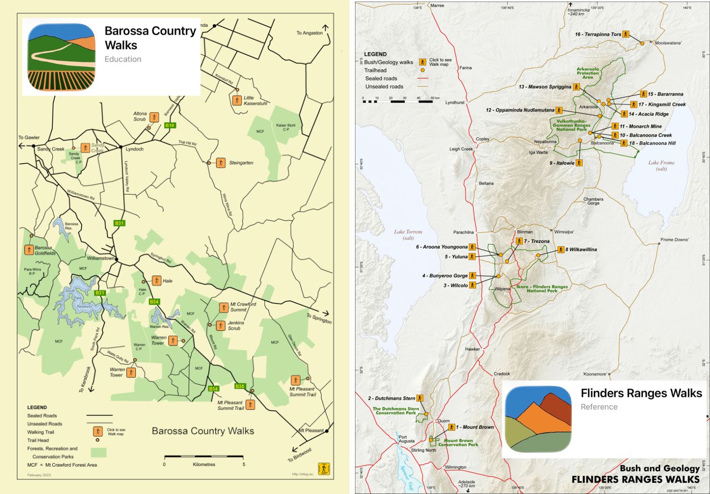
‘Bush Walks’ and ‘Country Walks’ were recognised as an essential component of the guidebooks and some RGS members, with suggestions from others including Peter Beer and Terry Lavender, identified 16 in the Flinders Ranges and 9 in the Barossa. They were all on public land – NPWS property, Local Government, ForestrySA but also including Arkaroola and Moolawatana Station – most willing and cooperative landowners!
After a positive stakeholder meeting in 1993, RGS members set out ranging poles along the Flinders Ranges Walk routes which were checked by local aboriginal people. And accordingly, some modifications were made.
It became clear that the RGS volunteers would be better working as a ‘Friends of National Parks’ group – which was styled the Walking Trails Support Group, not attached to any particular park.
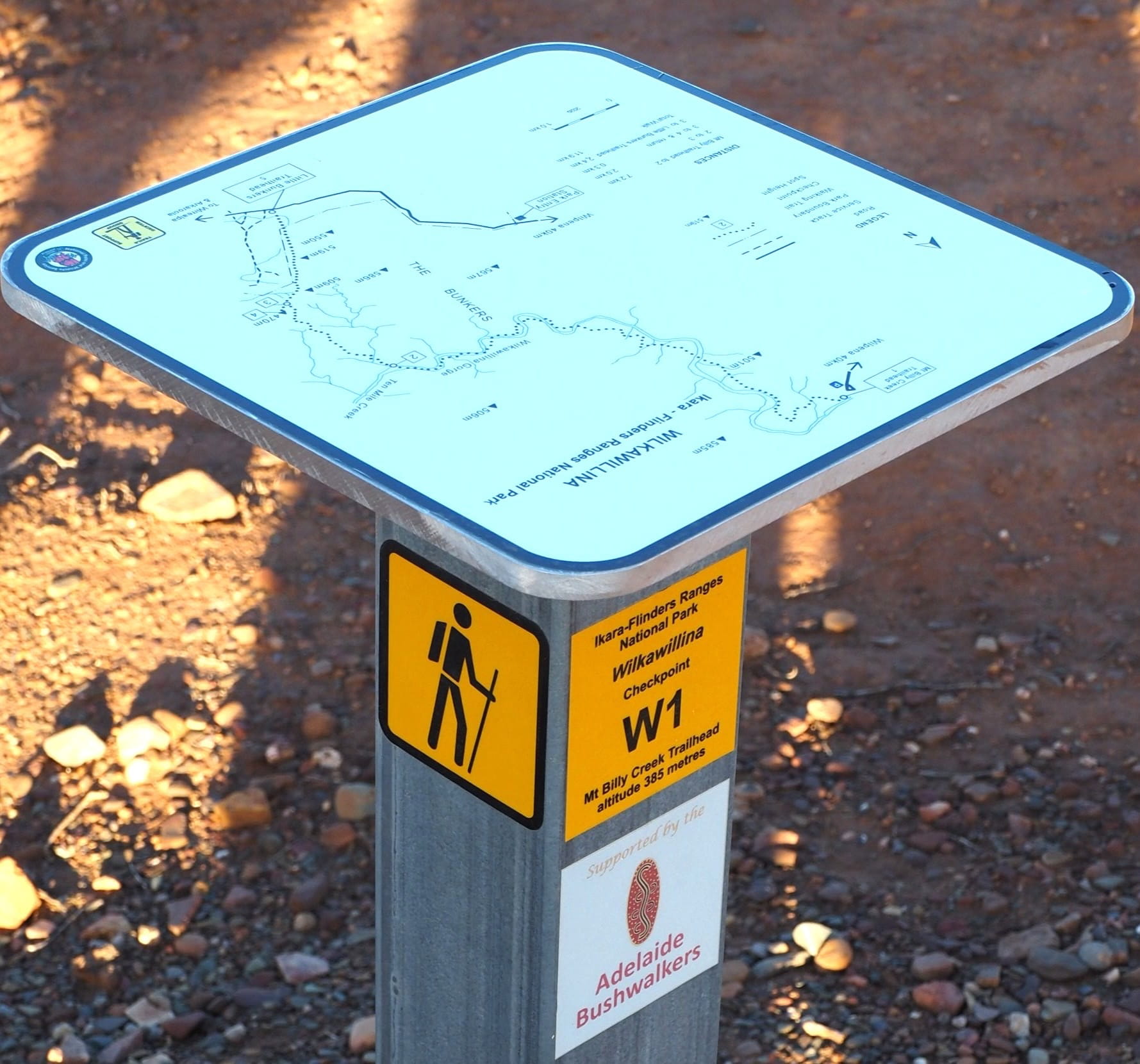
From the outset, arising from the RGS guidebooks, the prime intent of the walks is introducing visitors to observe and understand the landscape, so guideposts, distance makers and information leaflets were obligatory. Surplus 32mm Heysen Trail pole markers were accepted with alacrity! We soon found out why they were surplus … but some, amazingly, are still in use. Most have been replaced by 50mm steel posts which give 3 faces for distance – forward and back – and some even have geological information on them.
Information for leaflets had varied sources. Some came from familiarity of the WTSG members who walked the routes repeatedly, some from staff of Department of Mines and Energy and Department of Environment (and Planning). It helps to have a network, to let people know what projects are going on and worthy of volunteer or substance support.
Member networks help too e.g. ABW and WTSG Peter Beer (our President for 18 years), June Boscence, Tim Threlfall and other willing ‘track repairers – Lorraine Thomas and the Wards’. Through June’s good offices some important map plates were put in place for the remote but fascinating Wilkawillina walk – interesting botanically and geologically and how the two may be related. STOP to look at the landscape…
WTSG has a small but loyal membership of people who are prepared to spend up to six weeks in the Flinders Ranges during the winter months, and odd days in the Barossa at any time depending on fire season and other personal commitments.
The Group is unfunded. Activities as outlined here have been supported by NPWS in a variety of ways. Mostly by free accommodation in Shearer’s Quarters for 3 x 2-week trail maintenance sessions only – not for cheap holidays! We negotiate with NPWS for printing of leaflets and marker decals (shown in the pics) as the information is seen as important. Otherwise we apply for grants, sometimes with success.
Some members have been willing volunteers for over 10 years – every year, and that makes for good work planning. We recognise our volunteers’ capabilities and try to alternate light days with hard physical work. Not always easy, but the group tries!
WTSG trail maintenance for sustainability of marked trails includes: asset checking (all markers there and correctly labelled), drain clearing, fallen trees removed, weed control.
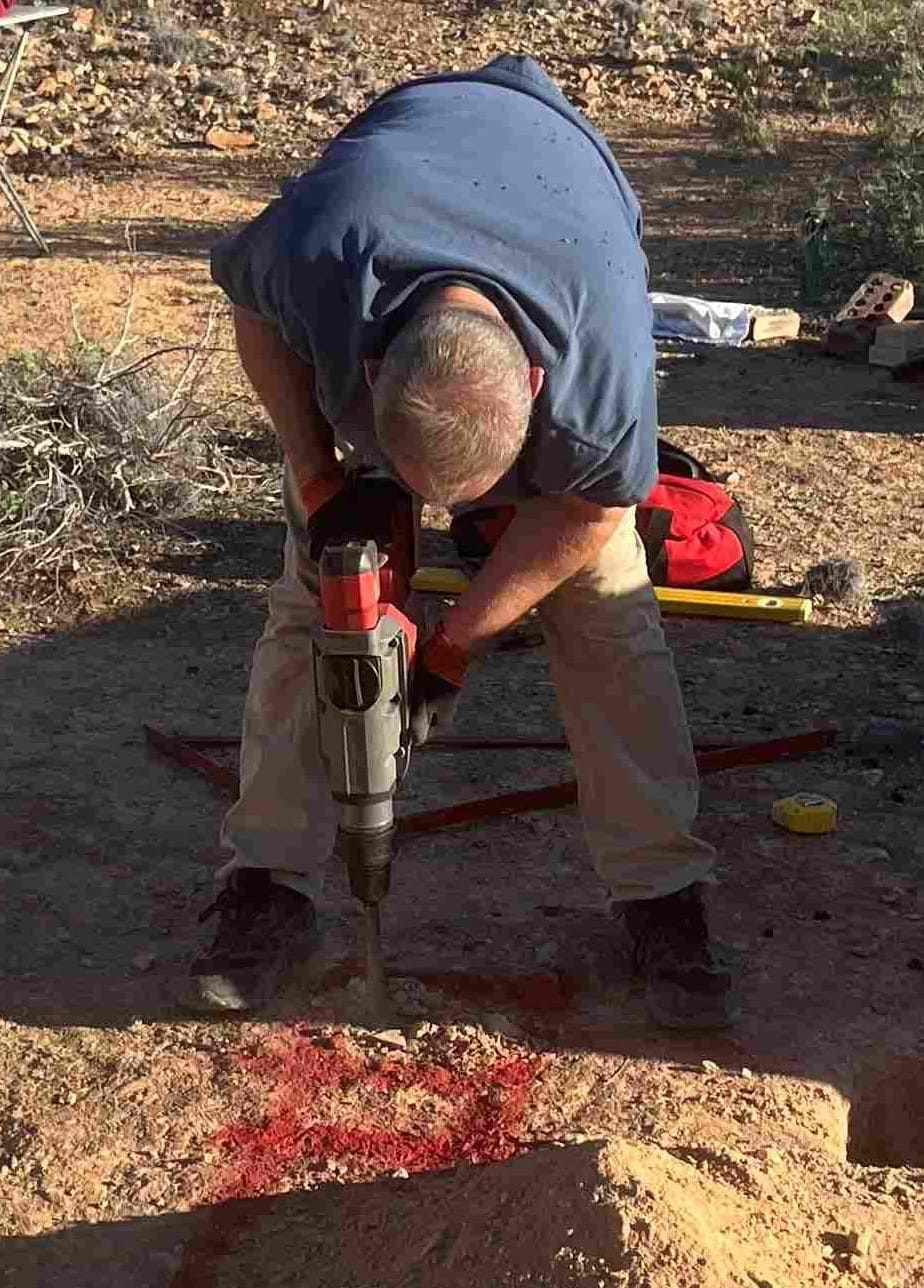
Field work can be quite heavy – hence the need for equipment like a jack hammer – and all tools are battery driven. Batteries are heavy and may be replaced in field by walker relays! Electric bikes and barrows have been investigated, but shanks’s pony is the most reliable after the car drop-off.
The rule is, no one walks or works alone. Inevitably, the work becomes too hard for some and they leave with regrets, or other personal responsibilities arise. We work in teams of 2,3,4 or more depending on what work is to be done. Recruiting is triggered by interest from word-of-mouth or the website, and we have an explanatory interview.
What have been the outcomes:
- Sixteen Flinders Ranges Walks (150km) 9 Barossa Country Walks (60km) ½ and 1-day excursions for the ‘average’ walker have been established and maintained since 1995. All the walk information is on the Walking Trails Support Group website.
- All clearly marked, leaflets available on the web and at Flinders Ranges trailheads; improvements have included staff inputs and ideas.
- Visitors reacted enthusiastically and provided us with very positive feedback. Helped by a geologist colleague, and with Ranger agreement, we have installed a number of posts which contribute very brief notes on geological history. A minor input to the concept of ‘geotourism’.
- Leaflets are limited in the information they provide. Visitors who seek more information find that App technology is the way for them – and us. TRY the Flinders Ranges Walks and the Barossa Country Walks apps free from App Store and Google and Google Play – an ongoing work needing FEEDBACK!!
We can now reflect on environmental change over 30+years. We have witnessed the effects of differences in the country largely as a result of severe flash flooding. First in Moodlatanna/Ten-Mile Creek about 1998, then Bunyeroo about 2010 and in January 2021, Enorama Creek. The stripping of reeds and shrubs has destroyed all-important creek habitat, with little sign of recovery. In all 3 locations it was possible to hear Australian (Clamorous) Reed Warblers in the cumbungi. Not now. Have seasons changed? Or is the season cycle 30+ years? Overall, the Flinders Ranges seem more arid. Flash floods may not be sufficient to replenish aquifers.
By Rob Marshall & Sue Barker/Marshall, Founder Members
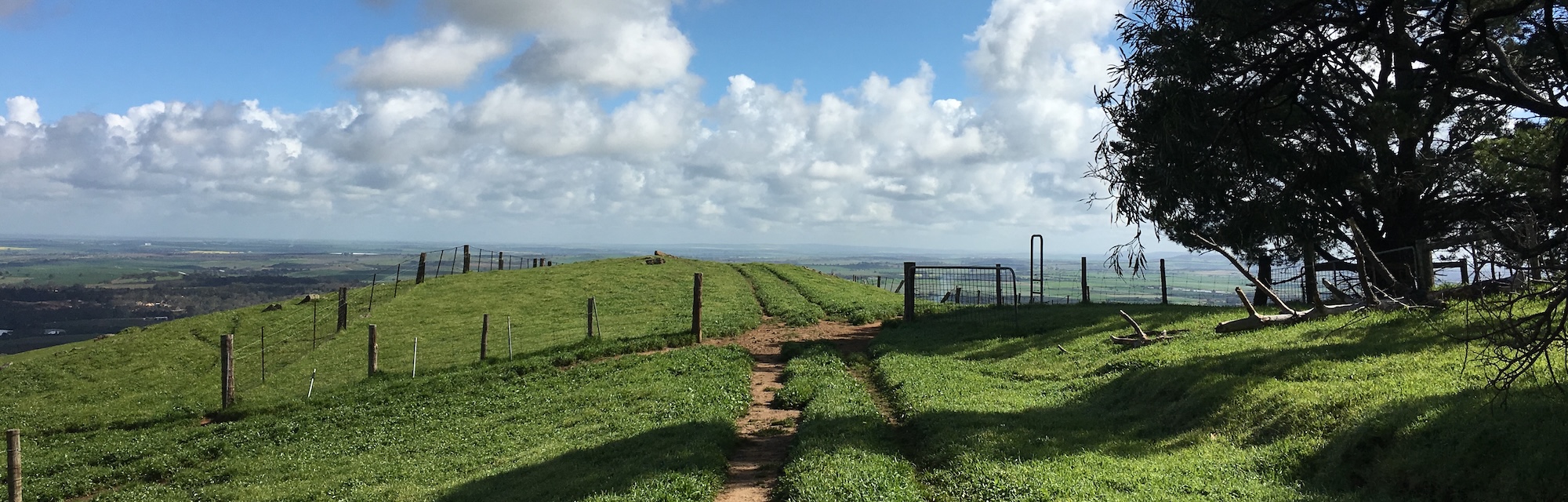
Image at top: on the Steingarten Loop Trail, Barossa Valley
Now read: A Tale Of Some Shonky Shoes
Comments (0)