
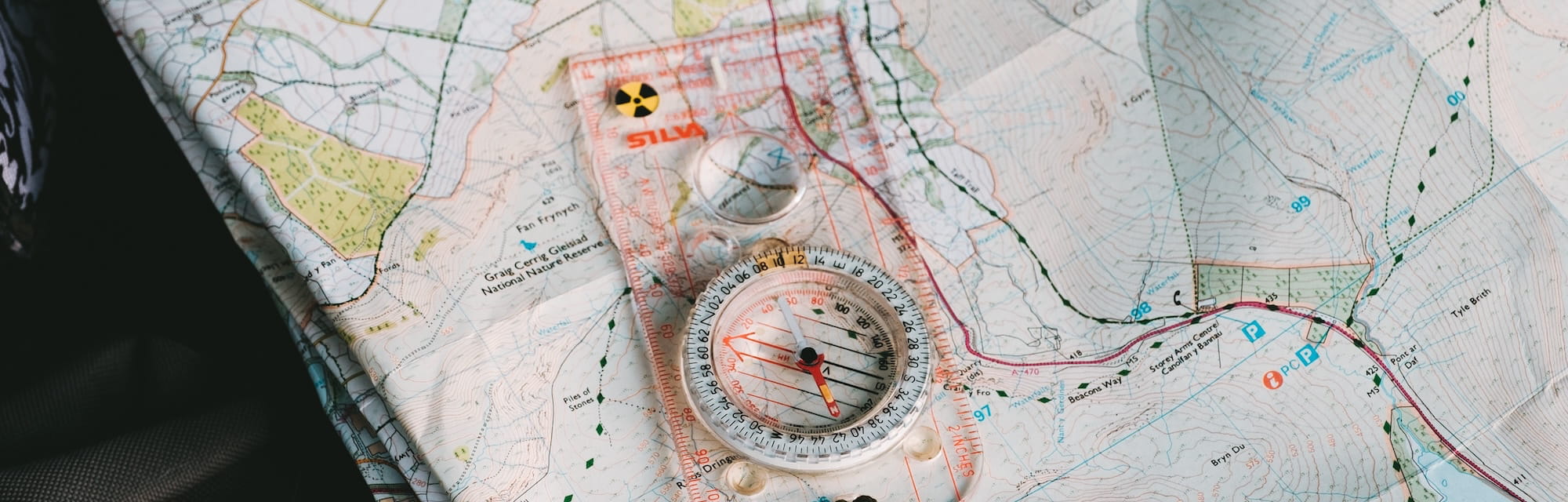
Although it is hard for many new members to accept, there was a time in our club’s history when digital maps, mobile phones and the GPS did not exist. But many notable walks some in wilderness areas were successfully conducted, how was this done?
This article seeks to demystify old style navigation.
In the absence of topographic information one had to look for whatever was available, geological maps, aerial photographs, cadastral maps, to name a few. There was a time when club members made their own maps based on the previously mentioned sources. The lack of topographic maps with contours made things more difficult, but the club did produce some really first class navigators. It was an absolute revelation when the first topographic maps of the Flinders Ranges began to appear in the early 1970’s
For new untried walks many hours were spent studying the various possible routes. Once a route had been settled it was pencilled in on the map. One technique employed was to break it down in to a series of legs and waypoints. The distances between these were measured on the map and totalled up to see what the estimated distance for that day was going to be. Based on past experience, an estimated time to complete this was calculated. On some walks, limited availability of campsites and sources of water meant that these figures had to be realistic, lest the party be benighted, maybe without water.
A waypoint serves as a navigational checkpoint to confirm that you have actually arrived at this location on the landscape. Point features such as summits creek and track junctions are good waypoints. A waypoint can have a dual function both to check for location as well as elapsed time, similar to a timed bus stop along a bus route.
It is important to not only know where you are on the landscape in relation to the chosen route but also where you should be in terms of elapsed time, that the walk has not fallen too far behind schedule.
The party proceeds from waypoint to waypoint as they traverse across the country. The more waypoints that are used the greater is the precision in navigation. A magnetic compass could be used to maintain direction when proceeding along the route, a series of magnetic compass bearings linking the waypoints together. A compass can also be used to check the direction of various features as a way of confirming your position. Another use of a compass is to orient the map, important when comparing map to landscape. If one was lucky there was an altimeter in the party to provide an additional input of elevation.
In addition navigation techniques such as aiming off, handrails and attack points were regularly used.
As a digression, to explain, aiming off is used to counter the effects of sideways drift when following a compass bearing to a point on a linear feature, such as a creek line. A deliberate offset of say 5 to 10 deg is added to the bearing so that one will wind up on one side or the other of the target.
Hand railing is widely used by orienteers so one follows a linear feature such as a creek line or coast line on a parallel course, but remaining in sight of that feature. Instead of laboriously following every bend or indentation or being hung up in the thick vegetation of a creek.
Attack point is locating a small feature such a campsite from a larger one, finding the large feature first then proceeding on a compass bearing over a short distance to the target.
The process of navigation can be made easier or harder depending on visibility and terrain. The most challenging combination being thick vegetation, rugged country and poor visibility due to weather conditions. Fortunately in places like the Flinders ranges the country is often fairly open with good visibility and weather.
In the writer’s opinion there is now far less cross country bushwalking and a much greater reliance on established tracks.
The navigators of old were certainly not perfect and mistakes were made but it was important to promptly realise when these had occurred, to make corrections and to bring the party back on course. Good navigators are eternally vigilant. Really good navigators can memorise the lay of the land and so are able to anticipate what they should see on the route ahead.

A paper map allows one to develop the big picture and to have an awareness of the lay of the land or the ‘grain’ of the country, something that a screen will not do. To plan the most efficient cross country route the ‘grain’ of the country should be taken into account to avoid unnecessary climbs or descents and to avoid steep hazardous features. Paper maps are not reliant on any electronic device, or receiving radio signals. There are no batteries to go flat. They never lock up or have to be rebooted. Like books the user does not have to know anything about technology.
To become a proficient navigator took time but if one was to become a leader there was no other option. However these skills are perishable and once acquired they had to be practiced, preferably by regularly leading walks. An integral part of this process was learning how to lead a party of walkers, which incidentally gave many a new club member a chance to experience leadership for the first time.
Map cases, compasses, GPS receivers and smart phones are too valuable to lose and past experience has shown that it is all too easy to leave them behind particularly at rest stops or lunch breaks. Important items such as these should be attached by lanyards either to oneself or rucksack or safely zipped into a pocket in the pack. It is also beneficial to leave both hands free in order to tackle obstacles.
A good map case is an asset for as well as protecting the map from wet conditions and can also contain, attendance sheets, route plans and navigation logs.
Limitations of maps
A map is a bland stylised representation of the landscape when viewed vertically. Whereas the navigator sees a scene full of detail and viewed from a low angle, with many features hidden behind folds in the country or stands of vegetation. The navigator has to reconcile these facts.
Maps are not perfect in every detail and the following factors are worth bearing in mind.
- Information may be out of date- check dates of aerial surveys, field revision and printing date of map. Digital maps are also prone to becoming dated.
- Fire trails are sometimes shown incorrectly- they may be on the map but not exist or not be shown when they do exist.
- Pine forests can be cleared and replanted, new vineyards and dams can appear, changes which may not show on the map.
- In more settled areas structures such as buildings and sheds are also more likely to change.
- Minor creeks do not necessarily appear on the map. Small watercourses are often not marked – but can often be deduced by the existence of ‘wriggles’ in the contour lines.
- The terrain is often more ‘lumpy’ than the map would suggest because features on the landscape do not show when they are smaller than the map’s contour interval.
- Very steep slopes with cliffs are not always marked on the map but can appear as contour lines which run together forming solid ink.
Unlike maps produced by government mapping agencies GPS maps like Google do not have to be produced to any particular standard and can be highly inaccurate. They should not be solely relied on especially in rugged areas.
In conclusion the author acknowledges that it is not possible to return to the past and the way in which things were done then, but is hopeful that this article may be of interest and use to the current generation of bushwalkers.
Comments (0)