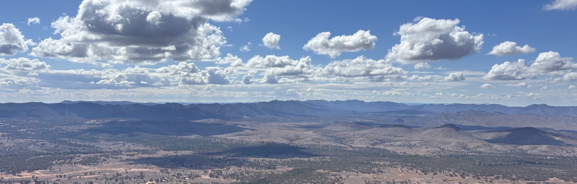
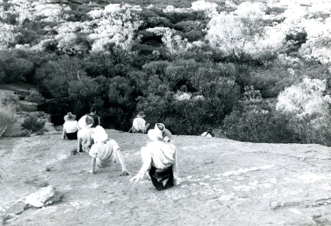
Patawarta Hill, an impressive landmark some ten miles north of Blinman, is a red sandstone peak, 3,306 feet high. It is at the south-western end of the pound-like formation which has Mt. Hack at its northern end, but unlike Mt. Hack, which appears simply as a bump on a ridge, it is a distinct peak rising well above its surroundings. A trip to Mt. Hack was described by Alison Beer in “Tarndanya”, 1967. [Mt Hack is the highest bump on the skyline above. Ed.]
This area is sufficiently far north, and off the beaten track not to be normally considered for a bushwalking trip, even on a three-day weekend.
However, we decided to go there on the June long weekend of 1968, while realising that probably at least as much time would be spent driving as walking.
Sleepy Blinman scarcely flickered an eyelid as we drove through on the Saturday morning on our way to Glass Gorge. The road goes north-west, out beyond the derelict copper-mine.
The Gorge is presumably named for the shining facets of some of the rock formations. It was an interesting drive, although rather unkind to the car tyres because of the vertical bands of slate protruding well above the surface.
At Moolooloo Station we ascertained that the road through Hanniman’s Gap was negotiable (although not recommended), and so proceeded on our way, by now well on to the “Cadnia” geological map issued by the S.A. Department of Mines.
A delightful, sometimes exciting drive, brought us to the Gap, which cuts through a ridge of Pound Quartzite.
The road through it was sandy and damp, but presented no problems. A belated lunch was eaten at the other side to the accompanying cacophony of a flock of protesting white cockatoos.
The road deteriorated rapidly after that, with bad washaways prevalent.
After about a mile and a half we gave up. We left the car, and set out on our walk, its main objective being Patawarta.
It was late afternoon as we topped a crest in the track and had a glorious view of Patawarta turned to gold by the descending sun rivalling in its vividness Peter’s orange rucksask, and even his jumper!
As we neared Patawarta Gap, we crossed a broad- grass-covered flat, and there, oblivious to us in the half-light of dusk, were some forty-five kangaroos grazing blissfully. Unfortunately, we could not help but frighten them as we continued on.
By the time we reached the Gap, it was dark, and so we camped.
There was no water, but this did not worry us unduly for we were well-supplied, and the weather was cool.
Next morning, we left our packs there and set out to traverse south-east along the ridge from the Gap to the top of Patawarta Hill.
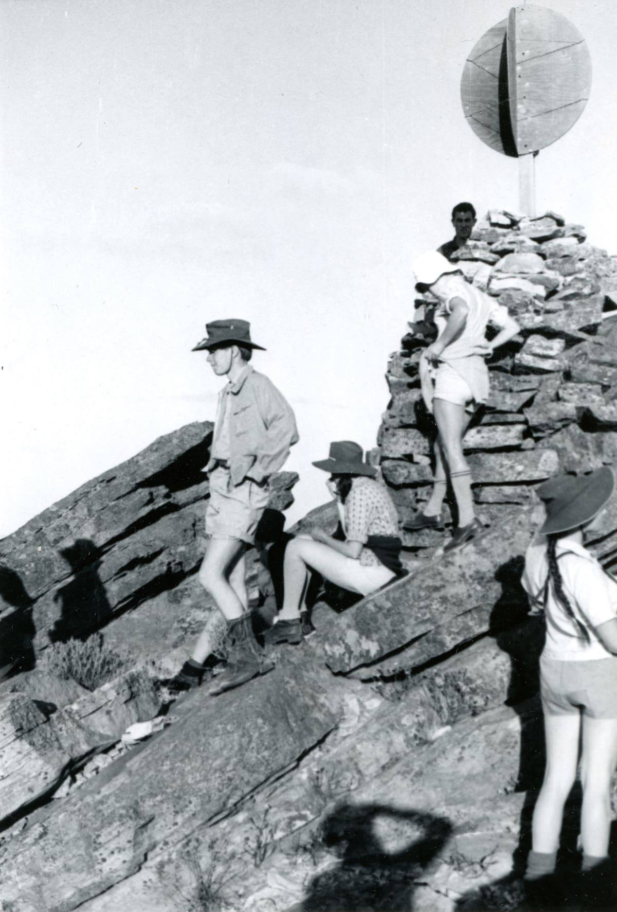
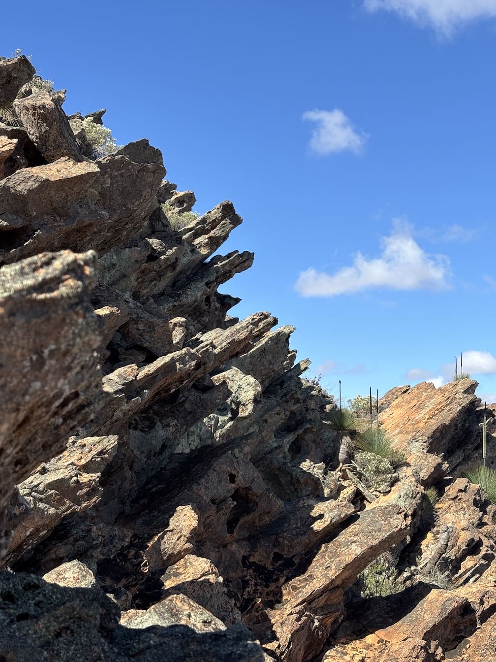
The climb developed into a pleasant rock scramble, with some larger “boulder problems” as we neared the summit. The vegetation was fresh and strongly-scented, and birds were common. Momentarily, as we clambered along a rock-terrace, we caught sight of a yellow-footed rock wallaby, its ringed-tail readily identifying it.
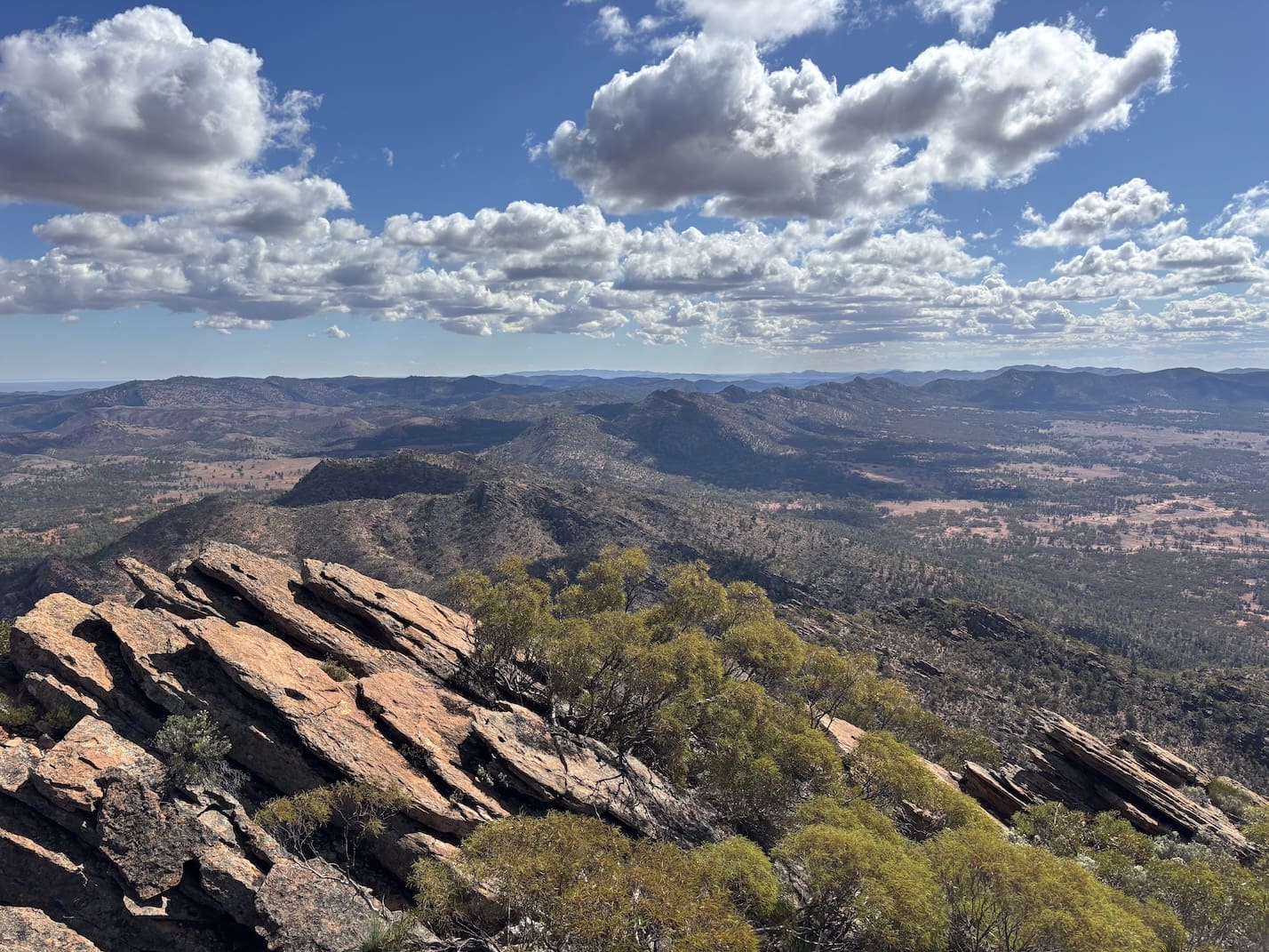
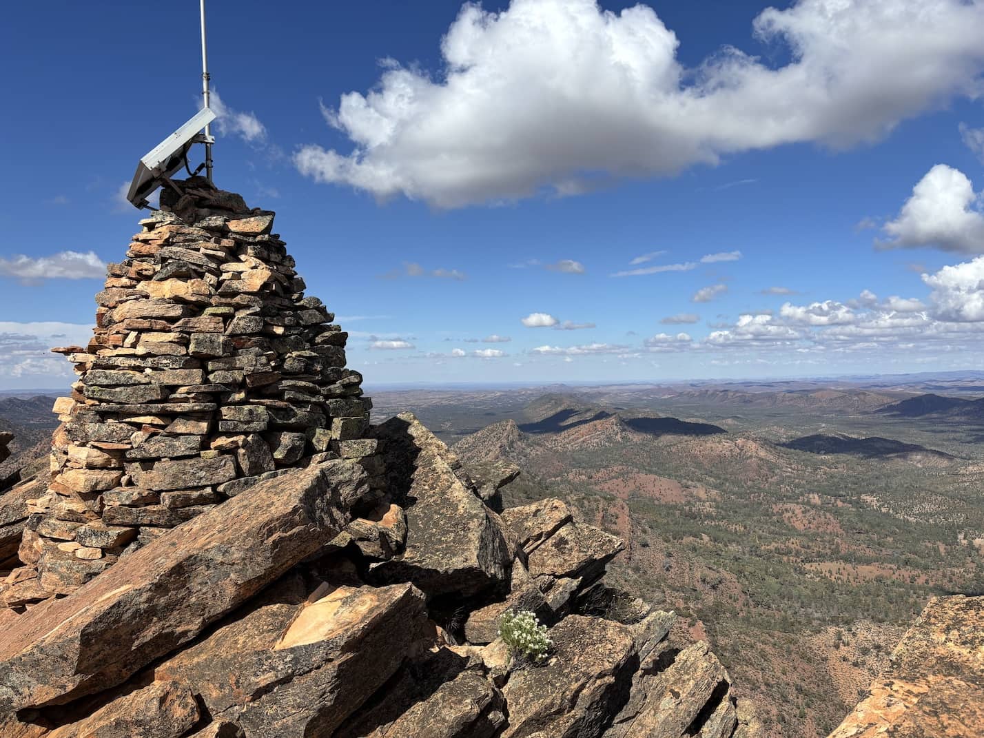
From the summit we had yet another awe-inspiring Flinders view, with layer after layer of folded rock formations snaking their way in every direction. Far off to the south-west we could distinguish every peak from St. Mary’s to Mt. Falkland. Inside the pound structure on which Patawarta is situated, was an idyllic scene with green grass providing a pale background to the thickly-growing native pines.
Within the pound is another pound structure of creamy-brown lime-stone, culminating in Ben Lomond, which was featured on the cover of “Tarndanya” 1966.
Eventually we tore ourselves from the view, and descended the relatively gentle slopes of the “back” of the Hill (i.e., the north-eastern side). We found small pools of water in two creeks, but these would probably be only temporary.
Back at our packs, we had lunch, and then headed towards the inner pound.
Because we did not have time to reach it, we contented ourselves with a circuitous route in the undulating area between the two ridges. Another dry camp was made, under some pines.
We quickly returned to the car next day, via the Gap. Then, unable to resist the temptation of trying to find a different route back, we decided to try to drive along the branch track running south-east past the ruins of Artimore Station.
A few miles were enough, however; we then walked the last mile to the ruins. These are quite extensive, and well-preserved, their most impressive aspect being the old shearing shed.
The timber uprights of the walls and yards, with many cross-beams intact, give the impression of a Stonehenge made of wood. There is a well-kept windmill there, since this property is now part of Point Well Station.
Above this picturesque spot loomed the omnipresent Patawarta Hill, which I now felt sure, having seen it from this southern side, must be the subject of Hans Heysen’s painting, “In the land of the Oratunga” [This was confirmed by Warren Bonython in ‘Walking The Flinders Ranges’ 1971. Ed.]
Time was really pressing now, and so we headed back to Adelaide via Moolooloo, Parachilna Gorge, Parachilna and Hawker.
Another Flinders interlude was over.
I remember a club bus trip to Mt. Patawarta led by Peter Beer at Easter quite a few decades ago. The club got into a fair bit of trouble with the bus company because this road certainly was not meant for a full sized 40 seater full of bushies. The walking trip started at Narrina homestead, across to Mt Patawarta and then to Artimore Ruins and finally ending up at the main road to Blinman and picked up by the poor bus driver. The driver had more difficulty getting out of the Narrina Homestead than getting in because there was no weight to assist the bus out. Checking on a modern map, the Narrina is a ruin and the road into it doesn’t ap pear to exist any more. Now this is what I call a REAL adventure (at least for the bus driver). I doubt whether any bus has ever been along that road since.