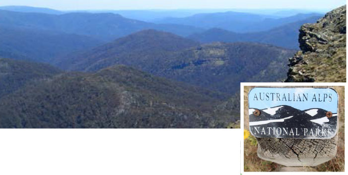
 The Australian Alps Walking Trail (AAWT) begins in Walhalla, Victoria and traverses the high peaks and plateaus of the Australian Alps to finish at Tharwa near Canberra covering a distance of about around 700kms. The trail passes through five remote wilderness areas with some parts undefined or overgrown and poorly marked so good navigation skills and equipment are essential.
There are no general stores or accommodation along the way apart from Mt Hotham and Thredbo Alpine resorts and there may be a need to carry extra water or search for water after a long day on the trail. The walk is logistically difficult to plan, physically and mentally demanding and typically, walkers put it off and relegate it to the too hard basket. With this in mind our trip was divided into three manageable parts with 18 days of walking in each, covering around 250kms and planned around seasonal conditions for weather stability and water reliability.
From Adelaide it requires days of travel and the placement of food drops in difficult to get to areas additionally hampered by seasonal road closures and 4WD tracks only, so detailed planning is essential before you start. For convenience and to reduce extra days of travel we decided on one food drop for each section. The food was a mixture of our own dehydrated and commercial items, enough for eight to ten days of hiking and packed into 20L, water tight, “Canoe Drums” along with extra fuel for our stoves and some clean clothes and luxury goodies like wine and chocolate!
As the end of my trekking days draw near I did not want this project to be drawn out over years and given seasonal constraints and particularly the questionable reliability of water I decided to start with the middle section first, Mt Hotham to Thredbo, in March, 2017, with section 1, Walhalla to Mt Hotham, the following November (2017) and finishing with section 3, Thredbo to Tharwa, in March, 2018. These are the best months to do each section but I will describe the walk in geographical order, from south to north, rather than chronological order.
Section 1 – Walhalla to Mt Hotham
(18 days, 260km, 16,260M ascent, 12,976M descent)
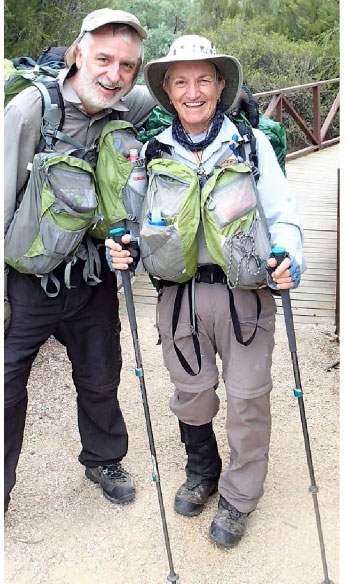
– Lorraine Thomas, Colin Kinnaird, John Glover
In November, 2017, four of us set out in two cars from Adelaide and overnighted in Jamieson, Victoria, from there we took the Jamieson Licola Road, reopened that day, to hide our food drums near the trail at Rumpff Saddle. We then travelled to Mt Hotham, left our cars in the long term carpark where we were picked up by pre-arranged commercial transport who would take us to Walhalla, 5 hours away. Our trek began with a brief walk around this historically rich town and we stayed overnight at the friendly Star Hotel vowing we would return here with our families some day.
Having packed in a lot over the past two days and we couldn’t wait to start the trail to “have a rest”! The trail starts gently at the rotunda directly opposite the Star Hotel and follows the path of the old timber tramway to the Poverty Point Bridge. It was an easy stretch by the time we reached our first campsite and it was only lunchtime but, being inundated with leaches we decided to move on. After 20.5 kms and 1,130m of ascent we were glad to see our Mountain Monarchs Campsite, a little known place not marked on the maps but complete with tent platforms, picnic table and reliable creek water. This was just a taste of the days to come where our daily average of ascent was usually over 1,000M and descent around 770M.
Over the next few days we continued through the picturesque Baw Baw National Park, just missing a dusting of snow, and then continued through the primordial State Forest, wading rivers, pushing through overgrown log strewn foot pads and cautiously negotiating very steep 4WD tracks. The campsites were compact and very appealing, the birdlife entertaining but there was little other wildlife apart from the feral pigs, wild dogs, goats and deer. From now on the trail becomes increasingly interesting as we enter the Alpine National Park and follow high ridges along the Great Dividing Range and descend into the plethora of deep valleys and saddles. The views are dramatic and sensational beginning with Mt MacDonald, Mt Magdala and Mt Howitt but the trail becomes more difficult to follow because of intense regrowth after bushfires and a profusion of fallen trees. Water becomes more scarce as well, sometimes up to two kilometres down a valley after we have made camp. November is the best time to start from Walhalla, after the melting snows of winter, and having such a late winter in 2017 we always found water but could see that these creeks would scarcely last a month longer.
At Mt Howitt we departed with the “Canberrans” who continued on while we whimpishly had a rest day in the Vallejo Gantner Hut at Macalister Springs. This is a great place to rest and wash up and the hut is comfortable even with seventy Timbertop students camping around us. They were so energetic, polite and courteous young people, off on the trail before we were out of bed! The weather by this stage was starting to turn with thunderstorms approaching each night but missing us each time and we knew our luck would run out soon.
Back on the trail we easily negotiated the Crosscut Saw, Mt Buggery and Horrible Gap then in the afternoon, halfway up The Viking the lightning and thunder started with vengeance as we were about to commence a pack haul and a rope assisted ascent through a steep “chimney” to get to the top of the ridge. We considered sheltering through the storm but the group wanted to push on as the track was difficult to navigate and negotiate and time was always a consideration when you don’t know what challenge will delay you next.
Fortunately there was a marathon running race along the trail and the organisers had marked and cleared some areas through this section. If not for this we would have endured 10-11hour days as it can get notoriously overgrown as the trail winds its way around rocky cliffs and ledges, up and down slippery, steep slopes with few markers to show the way apart from an occasional cairn! Having the GPX tracks available saved us a lot of time as well because it was so simple to quickly check if we were “on track”.
The storm continued through the night presenting more hail and lightening as the runners descended through our camp while we remained antisocial and cosy in our tents. As the ground shook with the thunder I wondered about the safety plans for the runners along that lightning ravaged ridge!
Source of the Murray River
From Mt Speculation water is scarce and careful planning between a selection of camps with new water tanks and reliable creek water is paramount. As we continued on, hill after hill, after hill, we had spectacular views from each crest watching the snowy slopes of Mt Buller disappear as the distance narrowed to Mt Hotham.
Black Allen Cairn
A nice cold beer and an indulgent lunch at “The General” store was leisurely consumed as we met up with our young Victorian hiker who arrived at Mt Hotham three days before us! This section is by far the hardest and on questioning our young friend he found it totally exhausting doing up to 30kms a day and he needed that time to recover before moving on to the next section. We parted company feeling much better at taking our time and drove down to Bright where we stayed the night before travelling on to Adelaide the next day.
Section 2 – Mt Hotham to Thredbo
(18 days, 259Km, 9,912M ascent, 10,065M descent)
– Lorraine Thomas, Colin Kinnaird, Sue Curtis
Mt Hotham to Thredbo was walked in March, 2017, with four hikers setting off from Adelaide and overnighting in Rushworth, Victoria. The following day we drove through Mt Hotham to the Benambra Corryong Road to place our food and water drop where the AAWT crosses the road. Returning to Mt Hotham we left our cars in the long term carpark and commenced our walk from there.
This section of the trail is most picturesque and incorporates various terrain from deep valley river crossings and dense vegetation to the sparse Alpine Bogong High Plains with sub-Alpine Snow Gum forest in between. The trail has no shortage of quaint alpine huts with fabulous histories and generally reserved for emergency use only, there is usually a water tank, pit toilet and plenty of flat space for tents.
The first part of the walk engaged these delightful hut settings which became a welcoming sight after a day of river crossings, very long, steep ascents and descents with the cold mist rolling in about 3pm. After spending a rest day in the comfortable Cleve Cole Hut (so we could do the side trip to Mt Bogong), we continued on to Wills Hut and again indulged a comfortable night by the log fire. From here the huts were scarce and we had to “rough it” and collect water from creeks and find suitable flat campsites. More steep sections were to follow, hauling water and camping on the track after Gill Creek. One of our favourite places was Taylors Crossing on the Mitta Mitta River, unbelievably warm, we were able to swim and do our washing before continuing on.
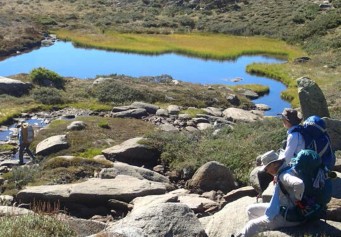
Tarn by the Granite Peaks. Ben, Sue, John
By now we were beginning to see more wild life, especially brumbies which appeared almost every day as we moved closer to Thredbo. A long, dreary fire track led us to the New South Wales border at Cowombat Flat where we spent our rest day scrub bashing through the dense tea tree forest, in a swamp, just so we could stand at the official source of the mighty Murray River. Venturing further on we located the hidden cairn that marks the start of the straight Black Allen Line that divides Victoria and New South Wales, with that we were feeling very pleased that we actually found what we had set out to do, a side trip well worth doing.
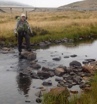
Colin crossing Eucumbene River at Kiandra.
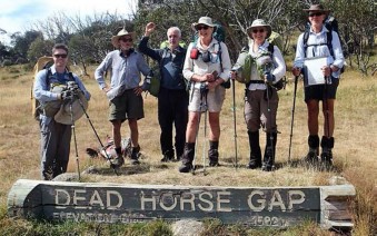
The Australian Alps walking Trail in NSW follows fire tracks all the way to Dead Horse Gap, but not unpleasant as they are grassy and soft to walk on. We only had two more nights on the trail staying alongside some of the best huts offering great views with magnificent sunsets to play cards (500) and beautiful sunrises to commence our daily trek, a lasting memory of this section of the trail. Eager to finish we got up early on the last day and arrived at the Thredbo Bakery by lunchtime. After a magnificent dinner at a Swiss restaurant we spent the night at the Thredbo YHA. The following morning we were taken back to Mt Hotham by a tour operator to collect our cars and head back to Adelaide, collecting our empty food barrels along the way.
Section 3 – Thredbo to Tharwa
(17 days, 246Km, 7,500M ascent, 8,290M descent)
– Lorraine Thomas, Colin Kinnaird, Sue Curtis, John Glover, Ben Campbell, Mike Round
The start of Section 3: Ben Campbell, Mike Round
Colin Kinnaird, Sue Curtis, Lorraine Thomas,
John Glover
This final section began in March 2018, again being the best time for weather stability in the Alps and we weren’t disappointed, I didn’t use my rain jacket once! While this part of the trail is easier than the other sections it is not without challenges. The high (above 2000M) open range can be subjected to high winds, freezing temperatures and thick fog in a matter of minutes so prior preparation and good navigation skills are again essential. Our first camp turned from sunshine to thick fog in 20 minutes and did not lift until late morning the next day so our planned trip to Mt Townsend had to be cancelled but we were able to visit Blue Lake.
The Button Grass Plains of Kerries Ridge (no track)
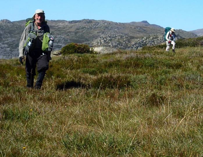
Much of the trail to Kiandra is on open fire track so we opted to avoid the “Ironway” to Mt Kosciuszko by taking the alternate route over the Rams Head Range and from Whites River Hut we took the alternate route over the Kerries Range to Mawson and O’keefes Huts. This untracked wilderness over buttongrass, swampy plains and granite outcrops is hard work but the rewards are worth all the pain! Wild flowers abound on the high barren Great Dividing Range at this time of year, and sweeping panoramas blow your mind so time out to reflect is mandatory. We were in awe of this beautiful landscape. To top it off and in spite of the challenges, Ben managed to produce cheese platters and wine every night for our consumption. Never before have I had delicacies such as this out in wilderness.
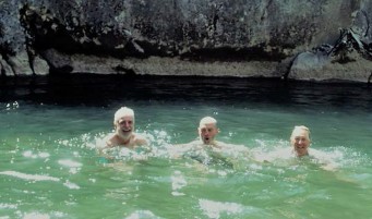
Collin, Mike, Sue cooling off at Blue waterholes
At the trail end we were welcomed by the rangers and staff at the Namadgi Visitor Centre, just south of Canberra. A mixture of emotions flood your mind as you remember those tough climbs through the alpine peaks, wild scrub and river valleys, and the footslog through the high plains, the extremes in weather conditions, the sensational vistas and all the fun times with exceptionally good company. This trail will remain one of the most memorable trips I have ever done.
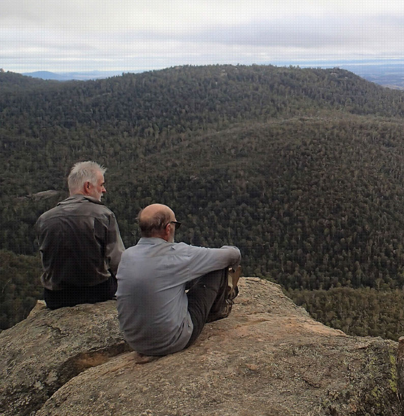
Colin and Mike at Booroomba Rocks looking toward Canberra on the last day.
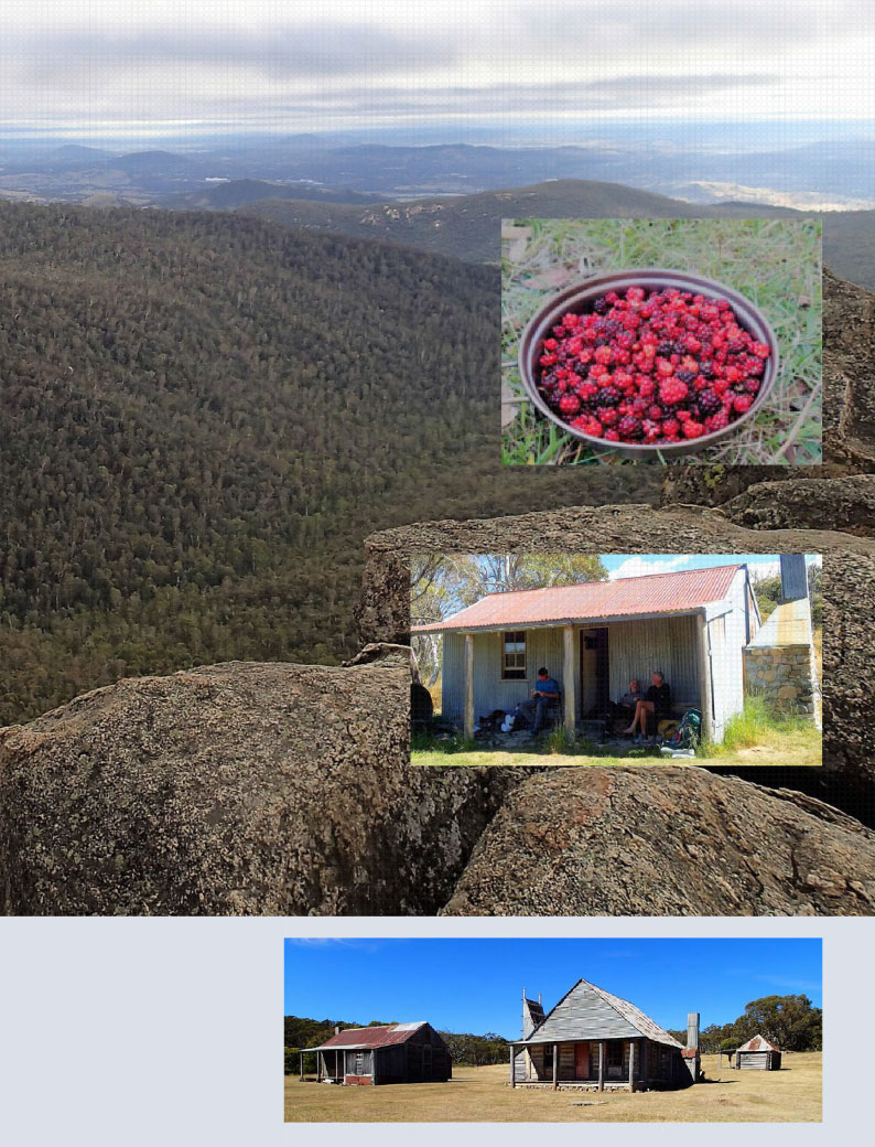
Above: Bush Tucker, keeping scurvy at bay with Native Raspberries! Below: Resting at Mackays Hut. Checkout the stone work on the chimney. Ben, Colin, John
Late congratulations for finishing the Trek Love the photos.From Carl Nov- Dec 2017 section